Beta Alp 4.0

A collection of information as it arises. There's not a lot out there!

Wednesday, July 12, 2006

Stella Alpina Day 8 - Cambrai to Home

After packing for the final time I set a course for home. I'd planned to follow the same route to Calasi as I'd come but lost on the Arras ring road and ended up doing a little detour to Vimy. In spite of this I arrived in the company of 4 other motorcyclists at the Chunnel terminus an hour early. The auto check-in machine gave me the option of an earlier train at no charge which I was very pleased about. This train ended up being delayed 15 minutes or so but was still an hour ahead of schedule. During the crossing I spoke with a couple who'd been on a World of BMW trip to the meeting at Garmisch on their newish R1200GS.
They'd had a good time and enjoyed the passes but like me got a little bored with the flat lowlands. Unlike me, this morning, they'd gone on the peage and done 150km in a thoroughly legal 90 minutes; it had taken me 3 hours and not on a pretty route.
In England I made good progress on the M20 and M25 with a rough ride a t70mph. My route on the Old North Road went exactly right this time and I was soon at Peterborough. However the last 100 miles home was so slow it seemed that I'd never arrive. My bum hurt, my ear hurt, I was hot and I thought I'd got an insect inside my helmet. The final 10 miles were the worst as I arrived in town at rush hour but didn't feel like dealing with the hustle of commuter traffic. Why are there speed cameras? 30mph, you'd be lucky!
It was great to be home, maybe that's the best bit of going away, even for a week?

Tuesday, July 11, 2006

Stella Alpina Day 7 - Dole to Cambrai

I had a broken night's sleep as the hostel was nosiy but the garage was secure in the morining and the Alp still there. Breakfast was fine, but in a restaurant building that smelt of baby poo. I'd give Dole FUAJ hostel a miss in future.
I'd planned a simple route and in that regard it worked well. Together with my detailed route card I only needed to refer to the map once. The first third of the journey in the edge of the jura was fine and quite picturesque but Ardennes is an arable desert; long straight roads in plains of crops. Apart from on the N74 I wasn't unduly bothered by traffic. Close to Rethel there was a policeman with a radar gun but that was of no worry to me as 1) I'd been warned by a motorist i the opposite direction and 2) I was going well below the speed limit anyway.

A few days in the saddle were getting to me in that I was getting saddle sore, even with the AirHawk pad, and my left ear was painful from the ear plug. I found another signed unsurfaced road and followed it to a cross at a junction and then down a wooded track which approached a farm; at that point I turned back. I need more info on these lanes as there are obviously very many of them and some parts may be interesting and the others worth some exploration.

I saw many of these roads which didn't have restriction signs and even though they are dull where they adjoin the road the few that I have followed have gained character within a km or so.
The 'dull' routes of the last 2 days have certainly been quicker and shorter than the 'intersting' outbound routes. It is better to be in at 17:00 and have time for a hsower before a pleasant evening meal rather than to arrive focussing on sleep. Whilst thinking about the speed, on European local raods the Alp can easily cruise at or above the speed limit and the lack of range is the limiting factor. A bigger machine would probably be more restful on long raods but I'd have to watch my speed. Maybe some AutoRoutes would be a good idea; as it is I've striggled to maintain an average of 55kph with no real meal stops and certainly no museum stops or visits. So I've had lots of motorcyclin gbut no tourism. Maybe that's OK? Today some faster roads would have been helpful to get across the centre of France.

A pretty easy 492km

Monday, July 10, 2006

Stella Alpina Day 6 - Bardonecchia to Dole

This was another hot and sunny day apart from the first few miles in the shadows of the valleys to Cesana. Setting off on the road to Col du Lautaret I realised that the road was being closed by the Police for a cycle ride. I suspect that they were stopping all traffic a few km behind where I was and that if I stopped I'd be made to move off the road and wait for it all to finish. As the road headed for the col the scenary became ever more impressive. I turned to Col du Galiber and the cyclists were to go straight on so there was a photo opportunity. My route holder broke it this stop so now I had no map case and nowhere to keep my route visible. It took me until tomorrow to think of a solution.

These roads needed a little concentration but not too much. It would have been tough on a pushbike. My plan to avoid Annecy and Albertville worked well but I ended up on a 'Route Barée' on a D road in the Massif des Bauges and had to make an expected detour along some pretty country roads.

However this brought me to the latter half of the day when I travlled to Dole on major N roads a little up the Rhone valley and then north west towards Dole. These were surprisingly traffic free and I could make good progress, although it was sometimes dull. Near to Dole the road passed between forests and there were occasional unsurfaced side roads into the trees. i spotted one with a '50' sign and turned into it thinking that it must be legal, or why else have a speed restriction? A km or so along there was a restricted turning, again, the restriction hinted that the main track must be legal.

After some water and chocolate, a balanced diet, I continued to the next turn on the mai track. Here there was an information board which said no motos or 4x4. Did it mean here, or actually in the woods? I wasn't sure so returned to the road and continued to town.
I found the hostel very easily but as I'd already been told that it wasn't very nice all of the defects were made very obvious to me and I even imagined more. A was given a garage key; was that a considerate gesture aor an indication that the moto would be stolen otherwise?
As I'd only been riding for 9 hours i wondered if I should go on, or have planned to go on. But no, that really is plenty.
This evening I started to see why you might cross France on the motorways. I reckon it could be done in a 12hr day at 120kph with some fuel and rest breaks. That would leave time to have a tourist day somewhere interesting.

442km without difficulty

Sunday, July 09, 2006

Stella Alpina Day 5 - The event

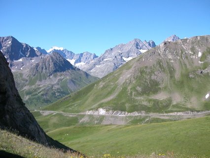
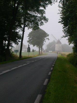
I got an early start at around 08:30 as I'd not had too much Italian hospitality and I'd heard that the hill got busy later. Certainly on the initial ascent from Bardonecchai to Rochmolles there were motorbikes coming towards me. I assume they were going into town for breakfast as they didn't have enough gear on board to be breaking camp.

I took the first half very easy as the surface was clay like and damp and every hair-pin seemed to have an adverse camber. (Later in the day these would be ploughed up.) I imagined that the surface here could be quite treacherous in the wet, even at the relative base of the climb.

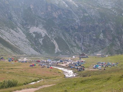
The campsite in the valley wsn't quite as extensive as I'd anticipated, but I suppose more than you'd find in the average alpine valley. A few tents were also pitched in other flat spots in the valley.

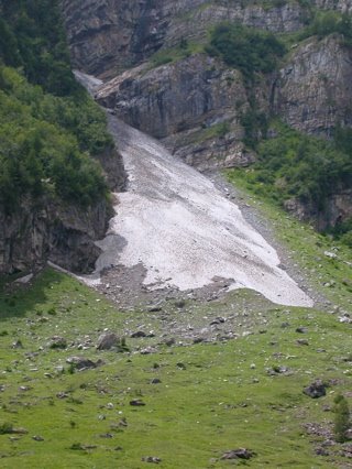
Gradually the track became more stoney, in places rock falls had spilled onto the track. Nonetheless, with care a rock-free path could be negotiated with only moderate care. As the track levelled towards the valley I took a little break. Some riders on road bikes were contemplating the sanity of continuing.

Beyond this point the track could be just discerned zig-zagging across a scree slope towards the col.

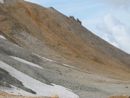
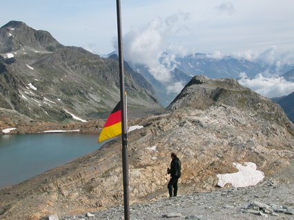
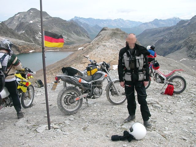
As the weather was warm and sunny there was no snow nor ice on the track but apparently as little as 2 weeks earlier the route was impassable beyond this point. With a quiet track and a small bike I quickly reached the col which was flat and very barren. The refuge that was to have been the start of a hotel complex has been demolished and all that remains is a ski-lift pylon and an information board.

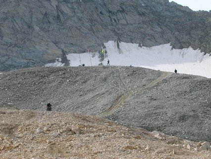
A couple of KTM riders had gone off-piste and were tackling the sides of an arete, leaving an orange trail in the gravel, occasionally attaining the crest, mostly tumbling off.

Adjacent to the col was a small hillock on which a German flag had been planted by an Africa Twin rider. As I watched someone on an LC8 tackled the ascent. After a few drops and help with lifts and some bravura he got there. I decided to walk up. The first section comprosed substantial stones, with no serious gradient, the second section was loose gravel with a longish steepish ascent. Not easy, especially on a big bike.

From the top however it was possible to see another route from the back of the hillock - apparently that was the way the German had made his ascent.


I reckoned that I could manage either route but didn't want to break either the bike or myself. After walking back down to the col I watched a few attempts on the hillock, some successful, some not, some on BMW GSs, some on 2 stroke MX machines. After what seemed like ages I decided to have a go. Try the rocky bit and see how that went - others had turned back at that point, I could too. Not many of the GS crowd had the guts (or muscle or money) to risk it.
The rocky bit was dispatched readily with plentiful paddling - I wasn't going for elegance but knock-free results. Then across the mud and snow bit and the track to the back. Easy! Now for the final ascent; from th rear of the hillock it was shorter and importantly less ploughed. Most folks had taken the obvious route. There was a good flat run up area too; plenty of throttle, weight forwards, shut off at the top and job done. Why had I thought it would be tough? A few Italians on trial bikes pootled up a verical face of the hillock and some other Brits arrived on DRZs and KTMs. I still claim the first British ascent of the day.


LC8 man stalled on the descent and skilfully skied the scree on the long face. I didn't fancy that and dithered down the shost face. The engine kept stalling but i eventually did what needed to be done and gave it a bit of gas and rolled down into the run-off area. Then it was simpel to cross the mud/snow area, the stones and regain the col.
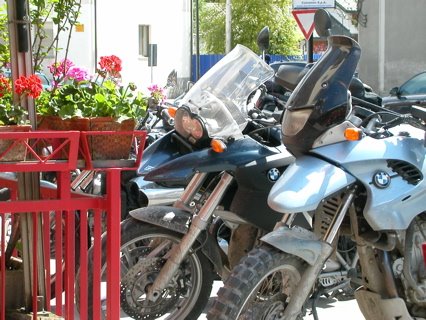
I headed for Bardonecchia once again. The track was now pretty busy and this was the biggest hazard. At each bend there was a cluster of big bikes with riders contemplating the next leg, and blocking the best lines. I nearly dropped the Alp on one such corner where I was forced onto the steep inner corner but with a firm foothold and a substantial heave the weight was caught. Couldn't have done that with a bigger, taller machine. The local bike club had set up a stall at the valley head, close to where I'd rested earlier and were selling badges, T-shirts and snacks.


This was the decision point for those on road bikes. This was a fair achievement but others reached the col, amongst them a Honda Silverwing, Ducati Monster and various UJMs. Well done.
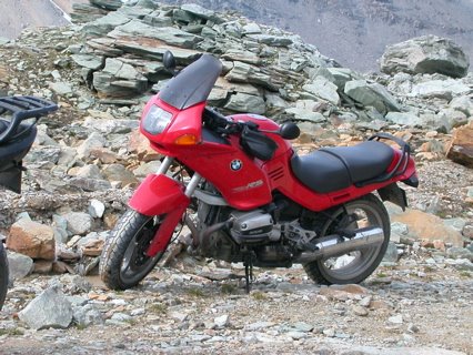
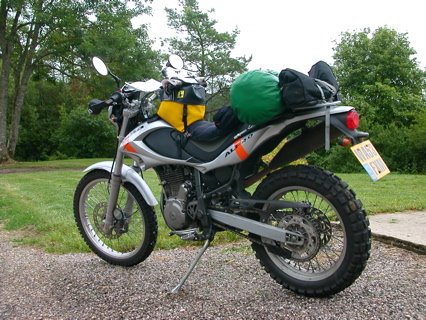
I got caught in a convoy on the descent and got terribly dusty; reached the hotel at 12:30. This wasn't a 4 hour journey - I'd just spent lost of time absorbing the atmosphere. I topped up with petrol and air - of course I'd let the tyres down - once to 20psi for the track and then the rear to 10psi for the hillock.
During the afternoon lots of riders were leaving town and I did wonder if I should have planned to do 100 km or so before the day was out. This year it would have been easy, but if it had been cold or wet it would have been less of a good idea.
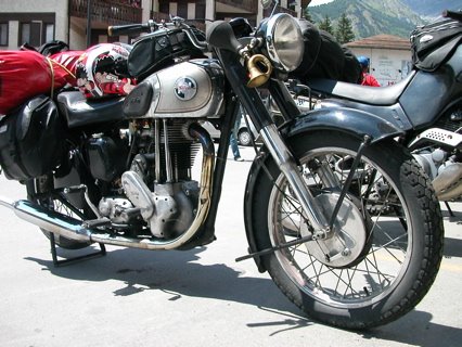
Later I met a group of riders on various classic machines, Matchless, R51 BMW, Honda XL. Inbetween discussions on politics, the 'green revolution' in farming and whether trail bikes should be allowed in MCC events we discussed there are stories about the Stella Alpina on the internet (like this one and mine!) but very little information. When I've finished this I may try to provide some info.

Saturday, July 08, 2006

Stella Alpina Day 4 - a trail ride and meetings

This morning I discovered that an indicator had ceased to work. A blown bulb I assumed but not the case. The ground lead from the bulb holder had broken. I managed to find enough slack to strip back a little and trap it between the bulb and holder. It doesn't look like a good long term solution but maybe it will last a few days.
Then I went off on my little trail ride (50km in all). Annoyingly, within a few km I'd lost my map and case; I retraced my steps but there was no sign of it. Luckily I was carrying a spare map but the absence of the case could prove to be a nuisance on the journey home as I had used it on the way to Italy.
I did a very easy ascent to a tiny chapel, well within a few hundred metres, I walked the last bit.

There was a stunning view from this little ridge.

I met a local Beta Alp rider who visited the area every weekend from his home in Turin. He felt like me about the machine, pretty good already but too heavy and not great suspension. We discussed the local legal trails a little before we both went on our seperate ways.
My descent took a different route to what turned out to be a nearly abandoned village. There I helped a French family move their Renault Kangoo which had become stuck on a steep slope
with one driven wheel off the ground. By wedging a stone under the free wheel and clearing dirt from the other we got it moving.
Then I continued uphill but the track steepened and narrowed. Either I'd gone the wrong way, or it was right but becoming potentially tricky, and maybe too narrow to be able to turn around safely. No sooner had I thought this than there was a nice level area in which I turned and headed back to the village.

Below the houses there was another track, which actually went thorugh one of the buildings. It was steep and stony but easily done feet-up at a slow pace. Then there was an unlocked barrier and just by the main road the red ring sign - so maybe not legal. Anyway I made a quiet retreat. Back to Bardonecchia, but I couldn't help going past where I'd last had my map. It wasn't there.
On the tarmac stretches I'd seen a few big trail bikes so it seemed that the event was getting going. Back in town it was evident that this was the case. In front of the 2 bars near the station was a posse of motorbikes.

Of course there were the obligatory BMWs

as well as less typical trail bikes


I introduced myslef to a group of English motorcyclists who in turn introduced me to Mario who'd started the whole thing 40 years ago. This group had been up to the col today as they thought tomorrow, Sunday, would be far to busy. I'll find out tomorrow.

Friday, July 07, 2006

Stella Alpina Day 3 - Les Rousses to Bardonecchia

Quite a day despite doing 'only' 331km. The first section continued through the Haut Jura and this is a superb area. Hilly enough to be dramatic but not so musc so to be frightening. I can understand why it is a popular walking area. The hills levelled ot to high pasture land with a very alpine appearance.


Next came the valleys. The first few were tight and narrow with the roads following the fast flowing rivers. The gradients and corners were relatively gentleand as usual, fairly traffic-free.
Eventually I came to Annecy and despite my concerns managed to pass around it without problems. The following section to Albertville was the most disappointing of the day. The lake at Annecy was a lovely colour but in the bid for tourism the road was lined with bars and small hotels, and all the traffic jmas that come with such attractions. Luckliy Ugine, juts before Albertville marked the beginning of my route into the Alps.

This is not one of the most famous passes but very fetching and cold enough to have a little glacier.

Next up was the famous Val d'Isere where I was concerned that I didn't have enough petrol to clear the pass. I met some German motorcyclists at a closed petrol station (English creit crads still won't work in the machines) who had come over the other way and they reported that there was no fuel for 40km. I'd risk it...The ascent all that I expected; steep tight bends and quite cold. I'd been warned about this so put some extra clothes on. I took the road pretty steady, this was no place to come off. There were a lot of cyclists too working their way up - no wonder the continentals do well in the Tour d'France.

It was also the first place where I got any hint that other motorcyclists were heading for Italy.


The petrol stattion was actually 50km from Val d'Isere but I reached it without problems. I thin one rides quite gently when it's a 1000m drop at the roadside. The Mont Cenis pass was straightforward and was followed by a pleasant descent into Italy where the sun was shining on the Susa valley.


Throughout the day the Alp had done well, of course I'd been passed and mostly when I was at the speed limit. There was nothing to suggest that on such a day that the machine was the limiting factor. Maybe a flashier machine would have increased my confidence and flattered my ability but I doubt it. At altitude, such as the 2700m col, the idle was unreliable and maybe there was a splutter when changing speed but on every corner I had power to pull away. I'm not sure that I was that happy with the tyres, they always felt a little remote. Perhaps the pressures were too high.
Somehow, in Susa, I ended up on the Autovia and so experienced a 5km tunnel - and a €4.50 toll.
It didn't take me long to find my hotel but somehow my deposit hadn't been paid. Anyway, I got my room and after a shower headed into town.

Well where was everyone? Maybe they were camping and most people don't arrive until saturday? Anyway I had a good meal and an excellent glass of Il Rosso.

The 1574km here has been a long way but enjoyable. I wonder what the weekend will bring?

Thursday, July 06, 2006

Stella Alpina Day 2 - Cambrai to Les Rousses

The main element of today was its length at 620km, a little less than I'd estimated, but I did use a short cut to avoid Besancon.

The first 100km or so were much like yesterday with large fields of green crops or ripening wheat. Then gradually the undulations became small hills and in each hollow was a copse of trees.


A little later the principle agriculture became forests on both sides of the road which now ducked and dived in and out of valleys. After a while the land became flat, almost as a pause before the green hills of Jura could be seen on the horizon.

It took me all afternoon to reach them and some heavy rain washed the roads down. Somewhere amongst this I noticed the lack of a headlight which I decided must be mended soon as it is required to be on in France. At one of my all-to-frequent petrol stops (less than 180km each one) i asked if they had a bulb - like the one in a car pack. Oh no, that's for cars not motos. The mechanic persisted and wouldn't sell me the bulb and so off I went. It was only a few km to the next place and they had a H4 bulb, as often fitted to cars, and aftre a bit of hassle finding the price it was mine. 6 fiddly screws later I'd got it fitted under their forecourt shelter. This has put me off 'extra bright' bulbs; there's obviously a shorter life.
After what seemed like ages i was down to the final 100km and the ascent into the mountains started. In Salins there was a frontier town attitude and the petrol station sold large petrol cans. I assumed it was the last petrol before Switzerland, but later realised that this was not the case as every town had at least one petrol station.

The hills were great, well surfaced even bends, a good gradient and no potholes to be found lurking around the corner. The hostel at Les Rousses is beautiful and highly recommended.

By following the minor roads I have often been at the 90kph speed limit, but with all of the villages and junctions my average was only 55kph .

Wednesday, July 05, 2006

Stella Alpina Day 1 - Home to Cambrai

After a lot of worry and debate I'd decided on a packing system with soft bags, putting the bulk of the weight on the pillion area. I estimated a total load of about 15kg total.

Off on a sunny morning, of course being a weekday it was slow going getting out of town, and that was to be the guide of the day. As usual the run through Sherwood to Ollerton was lovely and the following A46 slow and busy. As I left the A1 and headed to Melton Mowbray the sky was darkening and it was obvious it was going to rain heavily. Just entering the town there was a little drizzle and for a moment I thought "is this it?" No, in a few minutes a was getting wet and pulled into a side road by the railway to wrestle my overtrousers and waterproof socks out of their bag as the rain continued to drip down my back.
Once on the way again the rain persisted and with only a T-shirt under my jacket I could feel the pressure of the heavy drops on my arms and chest. Visibility was poor, even white vans were going slowly. Fortunately I could head south on "The Old North Road" which is a pleasant route not yet spoilt by excessive road furniture and roundabouts.
Somewhere near Bishop's Stortford I missed my turning for the A120 towards the M11 and ended up following the A10 onto the M25. As well as not being such a direct route the M25 junction eastbound was closed and so I had to detour to the west and back again through standing traffic. This must have added 20 miles or so extra.
Then just across the Dartford crossing the rain started again. At least the Toll was free so no messing about to find coppers; soon I was on the M20 and the final leg to Folkstone was fairly dry. On the motorway I'd been going at an indicated 70mph, this felt plenty fast enought, any more and a rather alarming head shake sometime set in. Not nice.
All day I'd been concerned about being in time for my crossing on the tunnel but timing was fine - 6.5 hours from home. Checking-in to my internet-booked slot was easy but by the time I was near the facility block it was time to get ready for boarding. This was a bit chaotic and could have been tedious in the wet, but it was dry! All of the motorcycles boarded a carriage after the last of the cars and had to park in echelon on sidestands; no special area nowadays. The train was very smooth and I just kept a hand on the Alp whilst the train brtaked to ensure it didn't topple.
Naturally I headed the wrong way out of the railport, partly because the roads seem to have been renumbered since my map was made, but this did give me a picturesque route to the south of Calais. The evening's ride was along a presumeably Roman road - dead straight.
Sometimes it was lined with trees, sometimes with Commonwealth war cemetries. No navigational problems except that on 2 occasions my preplanned distance was less than that on the road signs. The destination was getting further away...
In Cambrai I saw a HI sign but not one ofr the railway as I'd been advised and fearing that I was becoming lost I consulted a tourist map - on a traffic island of all places. That showed I was just a few corners away and in no time I was shown to my room and had the bike parked up.
After a quick shower I headed into town - it was starting to rain again. I ate in a pleasant Pizzeria and listened to chears from local bars as France beat Portugal in the World Cup semi-finals.

583km today